
.png)

The last widespread rain system delivered significant falls over much of eastern Australia, but as usual there were some parts that missed out.
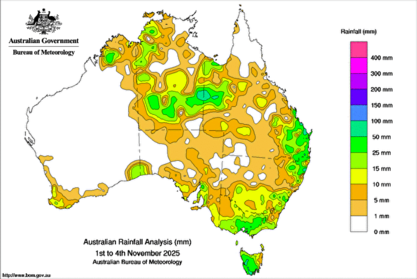
It was another example of tropical moisture pouring into low pressure and slowly moving eastwards, delivering a soak for those in its path.
The next one is lining up: over the west mid week, heading over central parts to end the week, and the east on the weekend.
We have been getting used to these textbook, classic examples of how Australia gets widespread rain.
But then the pattern changes. Next week looks different.
We still have plenty of moisture pouring in from the tropics, spreading across northern WA and the Top End.
But this time it doesn’t connect with low pressure, so it doesn’t head southwards or sweep across the south, because high pressure gets in the way and blocks the connection.
This doesn’t mean it won’t rain. What it does mean is there isn’t a tropical connection to ensure huge rainfalls.
Bursts of low pressure will still cross the south, and thanks to the positioning of the high, they should be carrying a punch of cold air.
This positioning also means that it’s the southeast that will feel the brunt of this, while the southwest is very different, on the warm side of the high.
There is likely to be a one-two punch of cold air systems crossing the southeast next week. One, followed by another, arriving about two days later.
You’ll hear about the low level snow heading to Tasmania and Victoria, and exclamations of “but it’s mid-November!” and if you’re like me, smile, and say yes, it can snow at any time of the year, you just need the right pattern to let the cold air come up.
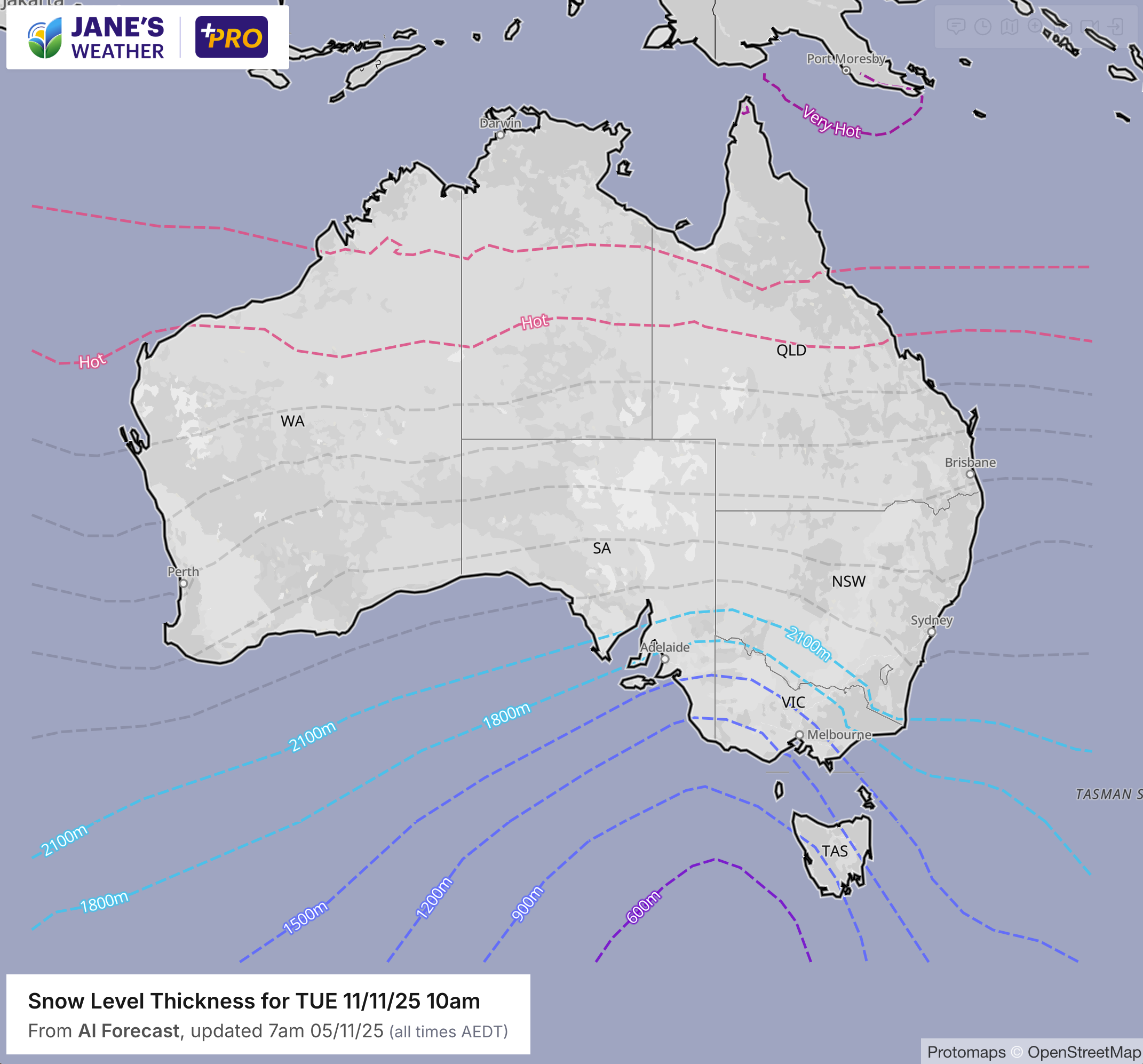
But if you’re in the southeast you’ll realise there is a bigger concern here: frost.
Each weather system will surge up from the south, bring rain that dissipates as it heads inland, make the wind blow and drop the temperature, then quickly move on leaving us with a calm and clear night.
And the timing, with the cold blasts spaced two days apart, means we don’t have just one frost, but two.
If you’re susceptible to late season frost, I’d keep a close watch on the timing of these systems, preparing everything you can to beat the chill.


.png)