
.png)

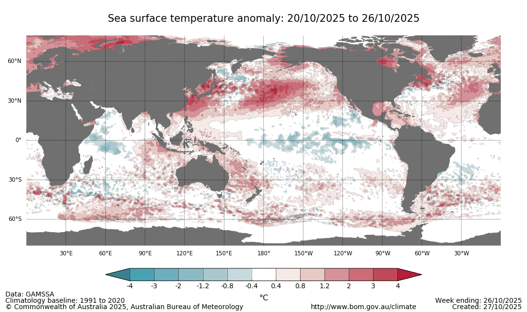
With a Negative Indian Ocean Dipole (IOD) and weak La Nina in the Pacific, both actively pushing moisture towards Australia, plus the warmer than average water around the majority of the nation, we have plenty of moisture to feed our weather systems.
That’s part one of the rainfall equation. Part two is instability.
Instability is delivered by low pressure, in the form of troughs, fronts and low pressure systems. And it is where these features move as to who gets the rain.
Overall, you can say we will have a wetter than average spring and summer.
But that doesn’t tell the full story, as the parts that actually see the above average rain are the parts that are favoured by instability.
A classic summer-time way to get rain is a trough snaking down through the eastern states. This acts as a boundary between moist air to the east and dry air to the west. Have a look at one of these on a weather map and show the dew point temperatures. You'll see high dew points (often around 15 to 25 degrees) to the east, and low dew points (often down around 5C, and sometimes as low as -10 or even -15 degrees) to the west. This number is representative of how much moisture is in the air, and is a great tool to check if you’re on the wet or dry side of the line.
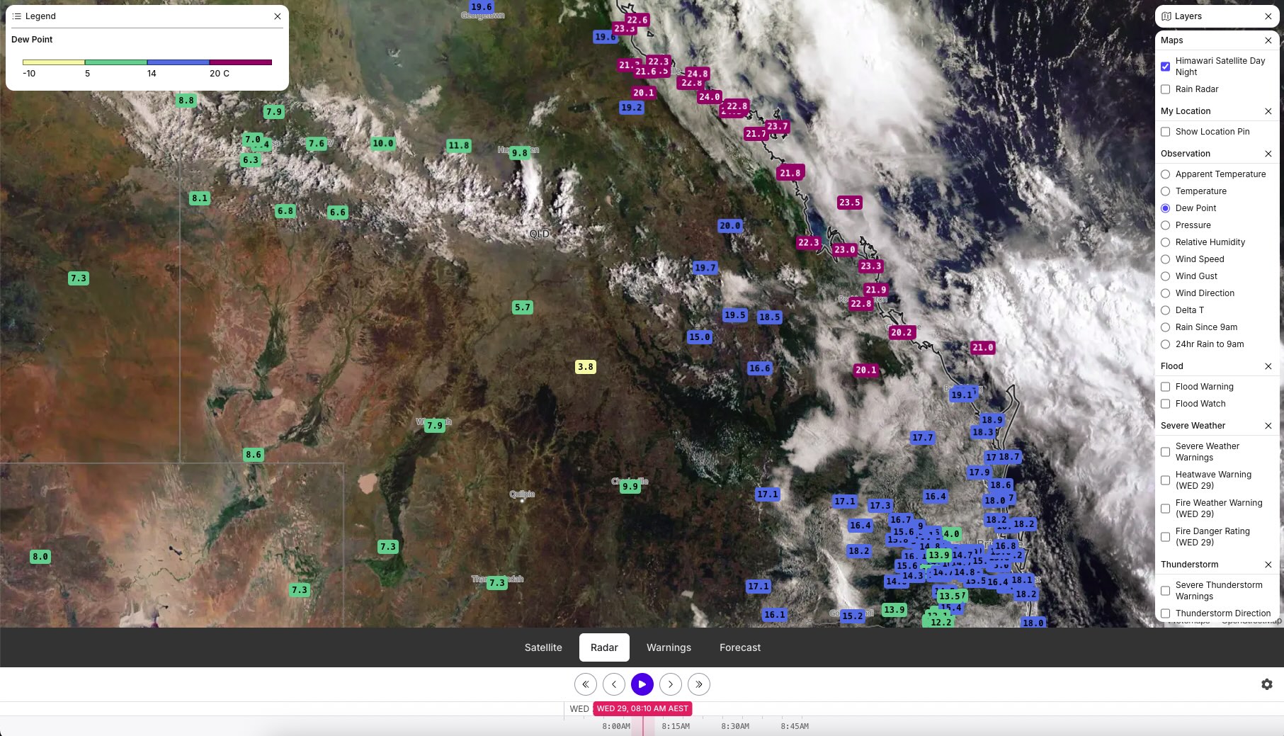
Being on the moist side of the trough doesn’t guarantee wet weather - just that you are in the zone for it. A trough usually produces showers and thunderstorms. These are by nature ‘hit and miss’, as they form in a closed off cell - the classic storm cloud with sunshine all around it. If you are directly underneath the cell you certainly know about it, while all those around miss out.
Troughs and fronts usually move, driven by low pressure systems. This combination can lead to huge areas of widespread rain, with embedded hit and miss showers and storms - and depending on the path, can produce wet weather from the top of Queensland to the bottom of Tasmania.
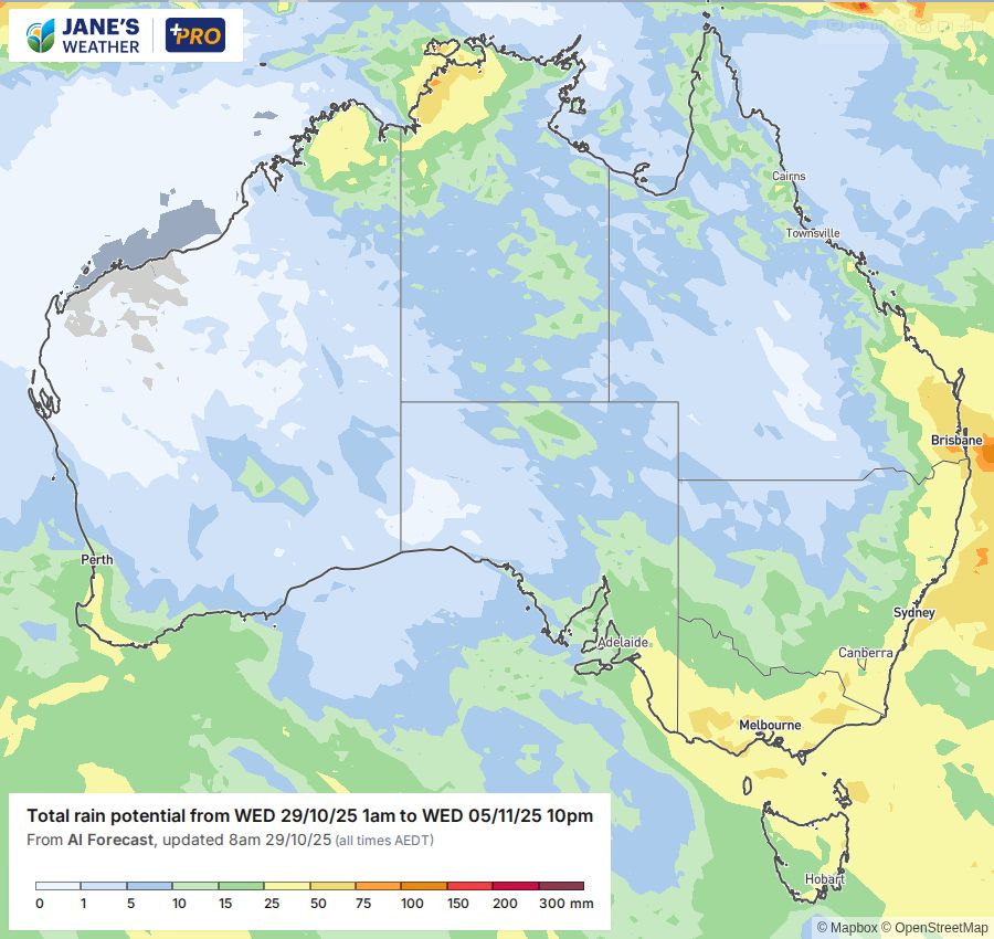
We’re likely to see another one of these in action early in November. Moisture pouring in from the tropics, running into a lengthy trough line, slowly pushed eastwards by a low pressure system. It’ll begin over the NT and SA, and move to QLD, NSW, VIC and TAS early in the week. The amount of rain you see is dependent on how quickly it moved through your spot, if you had a storm in the mix - and in the southern states how close you are to the low.
Then get ready for the next one to kick off.
.png)
.png)
